|
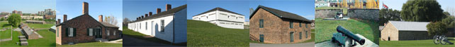
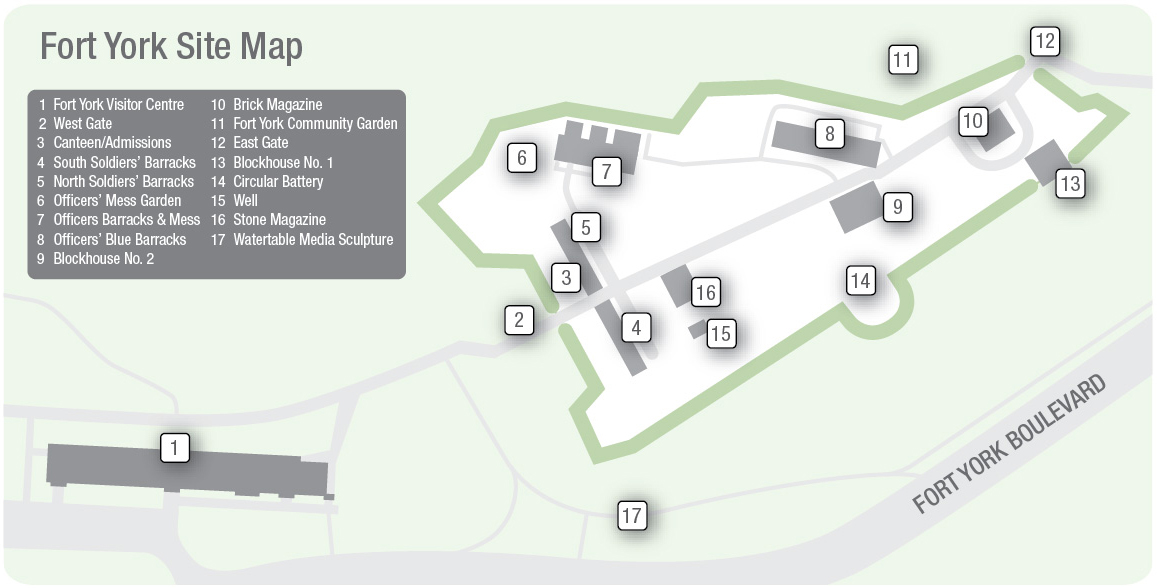
West Gate (Map reference #2):
The West Gate was protected by a dry moat, earthworks, and cannon. The earthworks date from 1805 and represent one of the few surviving elements of the original fort prior to capture and destruction in 1813.
South Soldiers' Barracks (Map reference #4):
North Soldiers' Barracks (Map reference #5): Constructed of brick in 1815. Both barracks housed 100 soldiers, wives, and children.
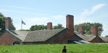
Officers' Brick Barracks & Mess Establishment (Map reference #7):
Constructed of brick in 1815. This building had private rooms for three senior officers of the fort, two servants/kitchens, mess kitchen, pantries, wine cellar, storage rooms, and Mess Dining Room.
|
|
Blue Barracks & Mess (Map reference #8):
A reconstruction of the 1814 wood structure which housed junior officers.
Blockhouse No. 1 & No. 2 (Map reference #13 & #9):
Two-storey squared timbered defensive structures built in 1813. They protected troops from small arms fire and light artillery while allowing them to return fire through loopholes. There were 13 blockhouses constructed in the Toronto area between 1793 and 1838. These are the only two surviving examples.
Brick Magazine (Map reference #10):
Constructed in 1814. Structural failure of the foundation forced engineers to convert the magazine to a storehouse in 1824.
East Gate (Map reference #12):
The East Gate marks the eastern limits of Fort York. In 1814 this was a much more imposing feature which was protected by the Gateway itself, the steep Garrison Creek, and embankment, the missing Guard House, a drawbridge across Garrison Creek and outer defensive works.
Circular Battery (Map reference #14):
The West Gate was protected by a dry moat, earthworks, and cannon. The earthworks date from 1805 and represent one of the few surviving elements of the original fort prior to capture and destruction in 1813.
Stone Magazine (Map reference #2):
Constructed in 1815, it was used to store munitions up to the Second World War.
|
 Structures